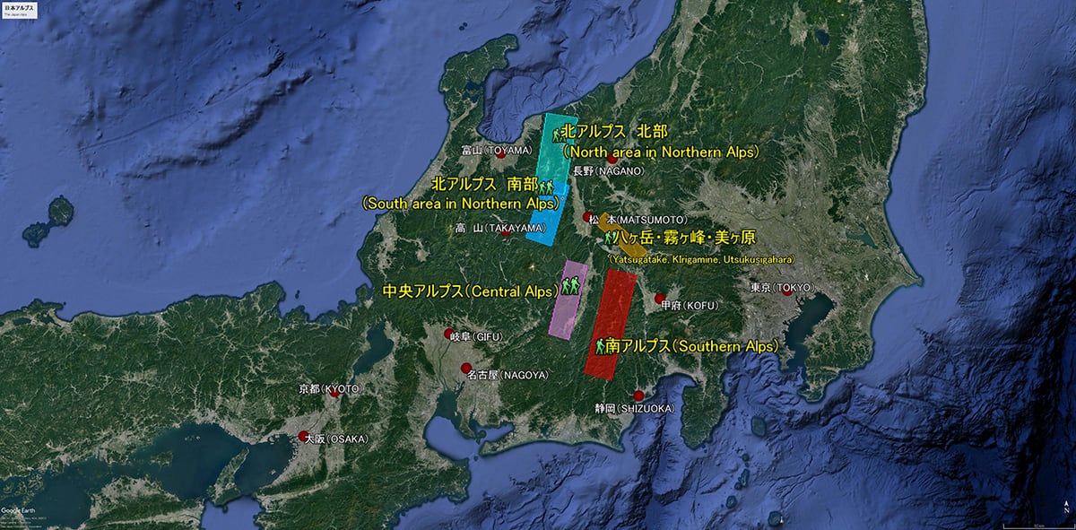
Northern area of The Northern alps
In the area where Toyama, Niigata & Nagano prefectures overlaps can be mainly found the Tateyama mountain range & the rear Tateyama mountain range.
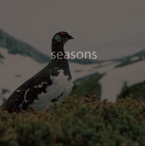
Known as well as an area of heavy snowfall, there are 6 confirmed glaciers in existence here today. Beginning with Mt. Tsurugi-dake & Kurobe Gorge, the snow and ice created the glacial conditions which fashioned these steep mountains and valleys which can be said to be the unique mountain environment representative of The Japan Alps.
<Tateyama Mountain Range>
This is the mountain range which extends from Mt. Souga-dake, located mostly in the north to Mt. Mitsumata-renge-dake, via Mt. Tsurugi-dake, Tateyama Mountains, Mt. Yakushi-dake & Mt. Kurobe-goro-dake.
【The100 Famous Mountains of Japan】
Tsurugi-dake(2,999M),Tateyama Mountains(3,015M),Mt. Yakushi-dake(2,926M)
Mt. Kurobe-goro-dake(2,840M)
【Japan 200 Famous Mountains】
Kekachi-yama(2,424M),Oku-dainichi-dake(2,611M)
【Japan 300 Famous Mountains】
Mt.Kuwasaki-yama(2,090M)
<Rear Tateyama Mountain Range>
This is the mountain range which extends from Oyashirazu, which faces The Japan Sea to Mt. Rengedake, via Mt. Shiroumadake, Mt. Goryudake & Mt. Kashima-yarigatake. In the Edo period (1603-1868), the historical naming was “rear mountain” which referenced Tateyama mountain range position behind the Toyama prefectural area where the Kaga Han was the local government.
【Japan 100 Famous Mountains】
Mt. Shirouma-dake (2,932M), Mt. Goryu-dake (2,814M), Mt. Kashima-yari-gatake (2,889M)
【Japan 200 Famous Mountains】
Mt.Yukikura-dake (2,610M), Mt.Harinoki-dake (2,820M)
【Japan 300 Famous Mountains】
Mt. Asahi-dake (2,418M),Mt. Karamatu-dake (2,696M),Mt. Ji-gatake (2,669M),Mt. Renge-dake (2,798M)
②北アルプス南部エリア(飛騨山脈)
●槍ヶ岳へ延びる二つの縦走路として、
<表銀座縦走コース>は中房温泉から合戦尾根を登り、燕(つばくろ)岳の稜線へ出、大天井(おてんしょう)岳を経て槍ヶ岳へ至るルート、
<裏銀座縦走コース>は高瀬ダムからブナ立尾根を登り、烏帽子岳の稜線へ出、水晶岳、鷲羽岳を経て槍ヶ岳へ至るルートが有名。
この二大ルート以外にも、常念山脈や穂高連峰、乗鞍岳など上高地周辺の日本を代表する山域から構成される。
日本百名山:水晶岳(2986M)、鷲羽岳(2924M)、笠ヶ岳(2897M)、槍ヶ岳(3180M)、常念岳(2857M)、穂高岳(3190M)、焼岳(2455M)、乗鞍岳(3025M)
日本二百名山:餓鬼岳(2647M)、有明山(2268M)、燕岳(2762M)、大天井(2921M)、霞沢岳(2645M)、赤牛岳(2864M)烏帽子岳(2628M)
日本三百名山:野口五郎岳(2924M)、三俣蓮華岳(2841M)、鉢盛山(2447M)
③南アルプス(赤石山脈)
南北120Kに及ぶ長大な山脈で、
地理的には甲斐駒ヶ岳をピークとした北部山脈、白峯三山を中心とした東側稜線、狭義赤石山脈である西側稜線の三つの山脈に分けられる。
日本百名山:<北部>甲斐駒が岳(2967M)、鳳凰三山(最高峰-観音岳2840M)
<東稜線>北岳(3193M)、間ノ岳(3190M)
<西稜線>仙丈ヶ岳(3033M)、塩見岳(3052M)、荒川東岳(悪沢岳)(3141M)、赤石岳(3120M)、聖岳(3013M)、光(てかり)岳(2591M)
日本二百名山」<北部>鋸岳(2685M)櫛形山(2052M)
<東稜線>農鳥岳(3025M)、 笊ヶ岳(2629M)
<西稜線>上河内岳(2803M)、池口岳(2392M)、大無間岳(2329M)
日本三百名山<北部>アサヨ峰(2799M)
<西稜線>茶臼岳(2604M)、奥茶臼山(2474M)
④中央アルプス・御嶽山 (木曽山脈)
岐阜県と長野県の県境に位置し、北アルプスや南アルプスに比べて標高が低くその山域も狭いく1つの山脈として構成される。
御嶽山は北アルプス(飛騨山脈)、中央アルプス(木曽山脈)どちらにも属していないが便宜上このエリアの中で紹介する。
日本百名山:木曽駒ヶ岳(2955M)、空木(うつぎ)岳(2863M)、恵那山(2191M)、御嶽山(3067M)
日本二百名山:経ヶ岳(2296M)、南駒ケ岳(2841M)、安平路山(2363M)、小秀山(1982M)
日本三百名山:越百山(こすもやま)(2613M)、南木曽(なぎそ)岳(1679M)、奥三界岳(1811M)
⑤八ヶ岳連峰、霧ヶ峰、美ヶ原
南北合わせて30Km余りの八ヶ岳山域とそれに連なる霧ヶ峰、美ヶ原といった高原地帯。
標高はそれほど高くはないが、どの山に登るにもアクセスが容易で、山小屋などの施設やその設備も充実している。
日本百名山:八ヶ岳(最高峰-赤岳2899M)、蓼科山(2530M)、霧ヶ峰(車山1925M)、美ヶ原(2034M)
日本二百名山:天狗岳(2646M)
日本三百名山:なし